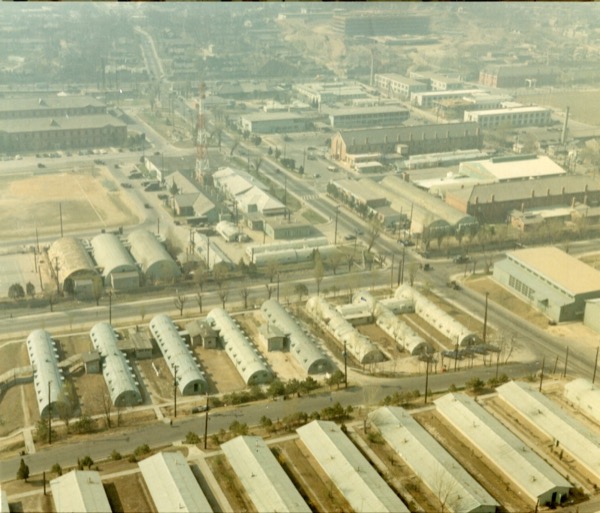
The 1948 aerial photograph shows how the Yongsan area was reorganized as military space in the period after liberation. Barracks, roads, rail lines, residential neighborhoods, markets, and the riverside all enter the same frame. It is a quiet but forceful record of a moment when military occupation and urban daily life were not yet separated.
What matters for an exhibition panel is the time sense carried by the phrase “just after liberation.” Liberation did not immediately mean the recovery of a free urban landscape. It was also a transition period in which a new military order was rapidly layered onto older spatial structures.
This photograph encourages us to read Yongsan not as a history of clean rupture but as a history of overlap. Colonial military space, post-liberation realignment, the Cold War base system, and today’s park discourse all gather on the same ground. The document helps make that layered history visible at a glance.
Related pages
/en/research-guide//en/posts/yongsan-from-above//en/document/