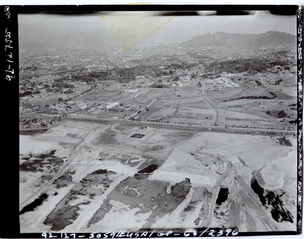
This week’s record is the 1963 aerial photograph of South Post and the Han River edge of Yongsan Garrison. The image brings the riverside, South Post, and neighboring urban space into one frame, showing how the landscape we know today was once arranged through military occupation and planning.
The strength of this document lies not simply in its age. More importantly, it allows a comparison with the present. It becomes possible to ask what has disappeared, what remains, and how current park debates are still shaped by earlier spatial arrangements. The older viewpoint throws today’s questions into sharper relief.
To read Yongsan’s records is not just to recover lost scenery. It is also to ask what kind of memory the present city and park are being built upon. This aerial photograph offers an especially strong visual starting point for that work.
Related pages
/en/items/1963//en/items/2017-4-4//en/posts/from-record-photo-to-park-discourse/